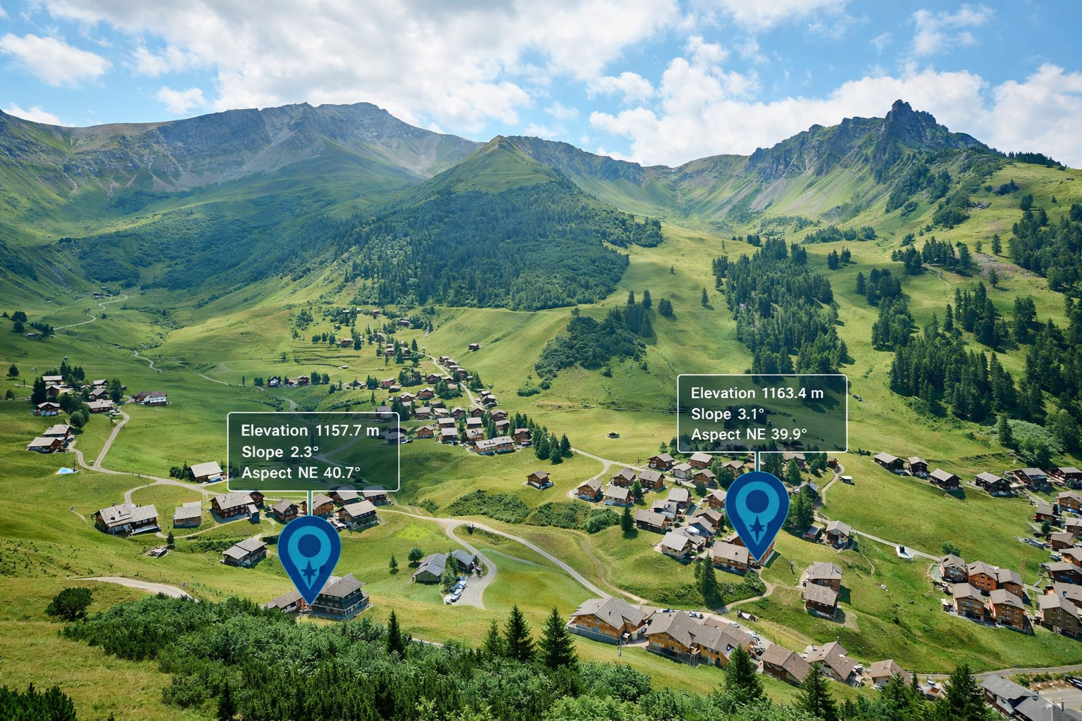
OnCoord has always been about connecting addresses to coordinates. With this launch, we're expanding what those coordinates can tell you. With the addition of elevation and site data endpoints, developers can now query elevation, slope, and aspect for any coordinate—opening up new ways to understand the physical characteristics of a location.
Make Better Decisions with Location Intelligence
Every coordinate sits on land with physical characteristics — elevation, steepness, and which direction the slope faces. These details matter across a surprising range of applications: telecom tower placement depends on elevation and aspect for signal coverage; real estate and construction teams use slope to assess build feasibility and drainage risk; logistics companies use elevation and slope to estimate true route difficulty beyond flat-map distance.
Flexible and widely available
Elevation and site data can be queried for any coordinate, whether it comes from a GPS device, GIS system, a geocoding result, or user interaction with a map. This makes it easy to add physical context to existing datasets without relying on an address lookup.
OnCoord provides coverage across Mexico, Central America, and South America. See our Countries page for a full list of supported countries and data coverage.
What's available: Elevation in metres, slope in degrees, and slope aspect as both a compass direction (N, NE, E, SE…) and a degree bearing. All three are returned in a single API call.
For OnCoord, terrain intelligence is a natural extension of the mission: make it easier for developers building applications in Latin America to get reliable, actionable data about the places their users care about.